OreFrame · resource estimation platform
Three modules, one platform, one orebody. Data puts the geology on screen in minutes, whatever it arrives in. VarioForge carries the estimation — variography, domains, kriging — interactively. WorkflowCanvas holds the method as a routine your whole team can read, and drives the packages the mine already pays for.
One project, one truth, and an audit trail already written when the auditor asks for it.
Runs in Chrome, Edge, Firefox and Safari · nothing to install
The state of play
A resource estimate is assembled across a chain of software that was never designed to work together. Each package has its own file format, its own licence, its own interface from fifteen years ago, and its own idea of what a drillhole is. What crosses them is a geologist's reasoning about an orebody, and that reasoning is not written down anywhere.
Geological modelling in one package, estimation in another, plots in a third, cleanup in Excel, and a Python script holding the joints together. Being good at the geology is no longer enough; you have to be good at five interfaces, and the person who is has a queue outside their door.
When the report has to be signed, someone spends a week rebuilding what was done: which file, which cut-off, which search, which version. The estimate is a legal document, and almost none of what produced it was ever recorded.
So we built the layer above.
Your packages keep doing the work. OreFrame is where the geology, the method and the record live, in one interface, on one licence.
One platform, three modules
The modules are not three products bolted together. They share one project, so the domain a geologist draws in the first is the domain the second kriges and the third publishes to the mine.
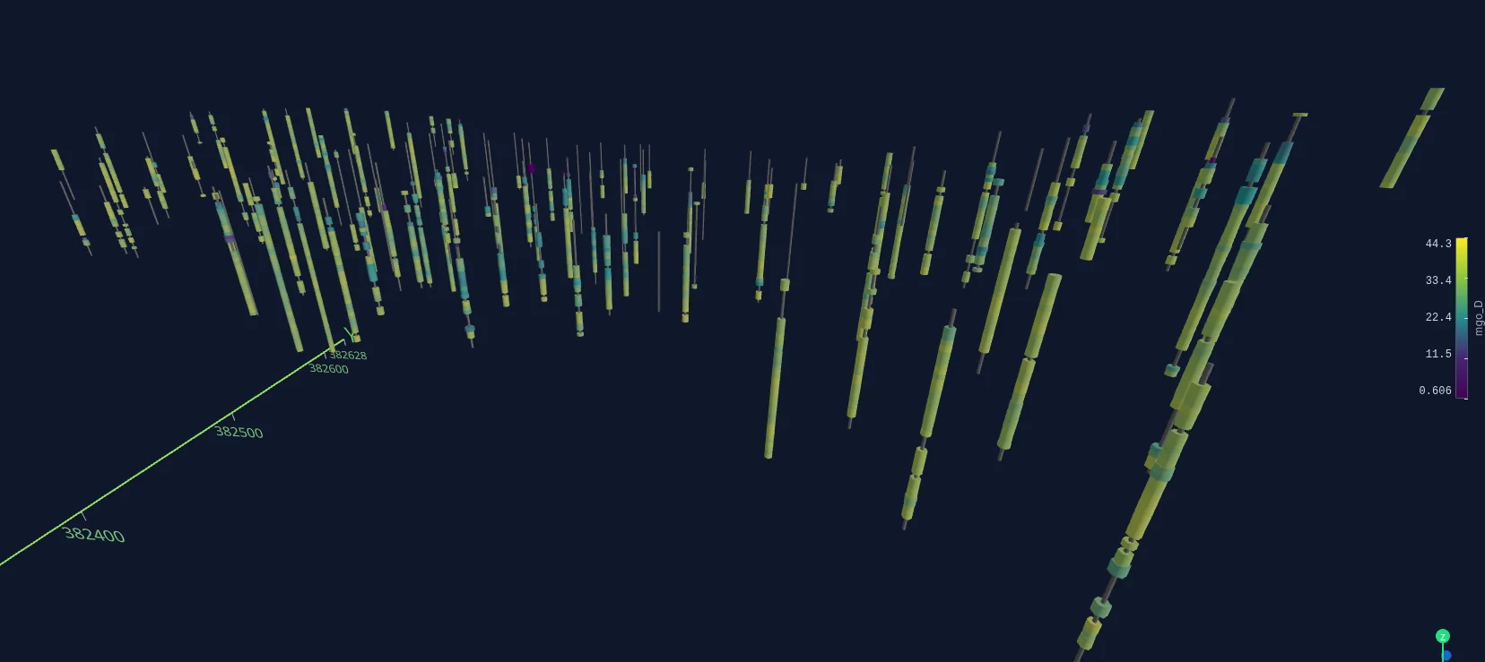
Drop the collar, survey and assay files in whatever they arrive in. Type the source EPSG and the deposit is on screen at its real coordinates, with terrain and satellite under it, in minutes. A projection mistake is caught in the first thirty seconds instead of in the block model.
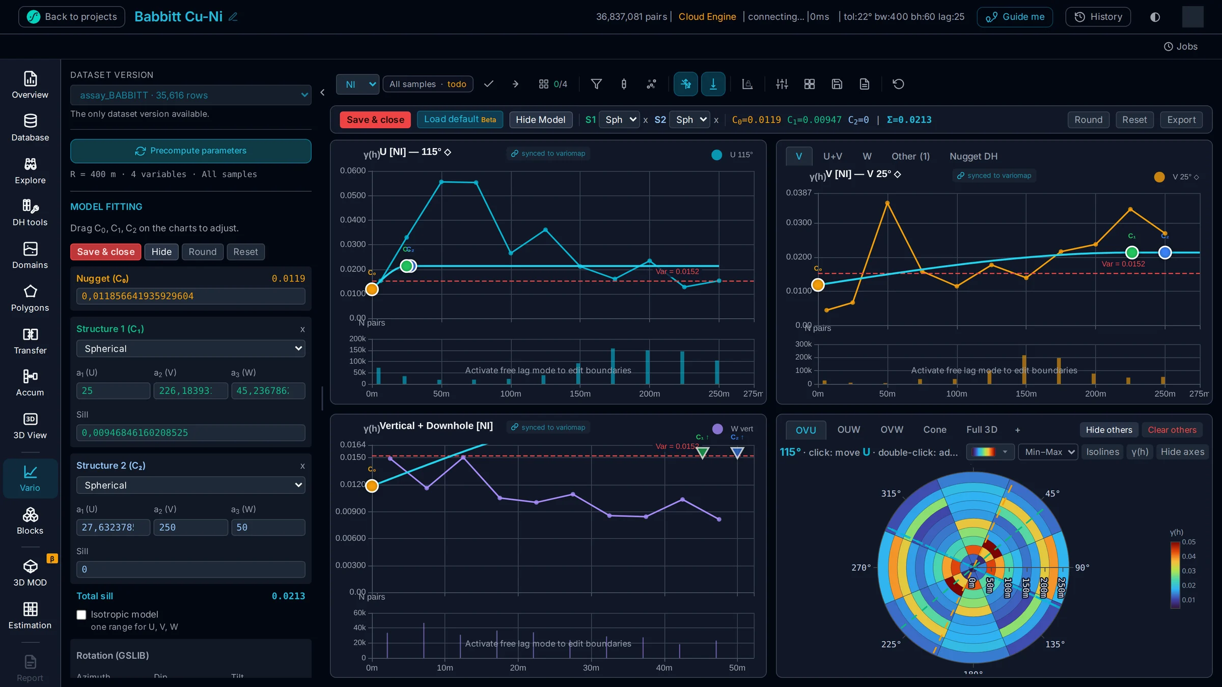
Domains, variography, block model, kriging, on a calculation tree rather than a recompute. Move the azimuth, the tolerance, the grade or the domain and the answer is already drawn. Four grades against three domains is an afternoon, not a fortnight.
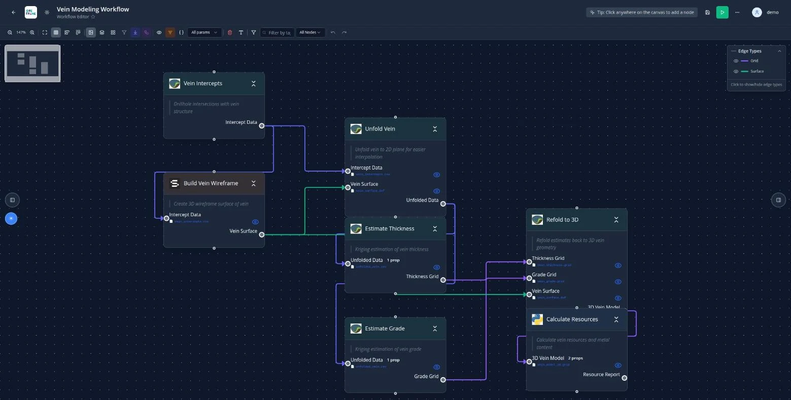
The method as a graph: nodes, typed ports, parameters on the face of each step. Run it and it drives Datamine, Surpac, Isatis, QGIS and Python in their own syntax, with the run history kept. A graduate can follow it and an auditor can review it.
Geology, not charts
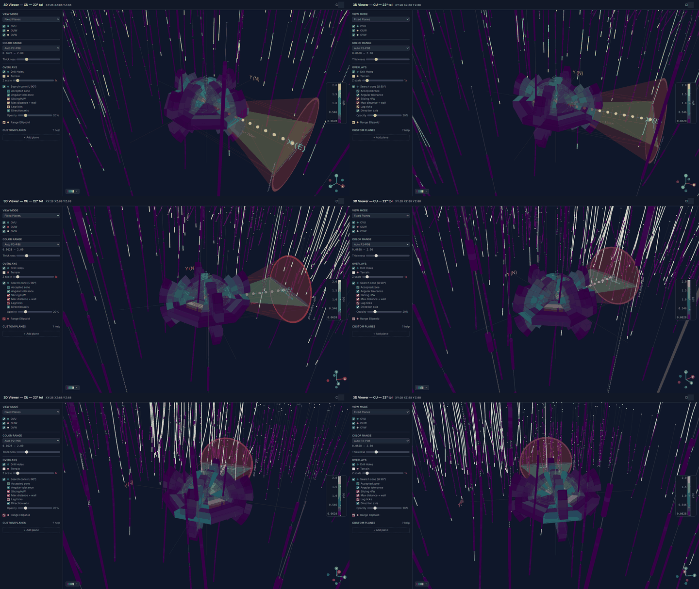
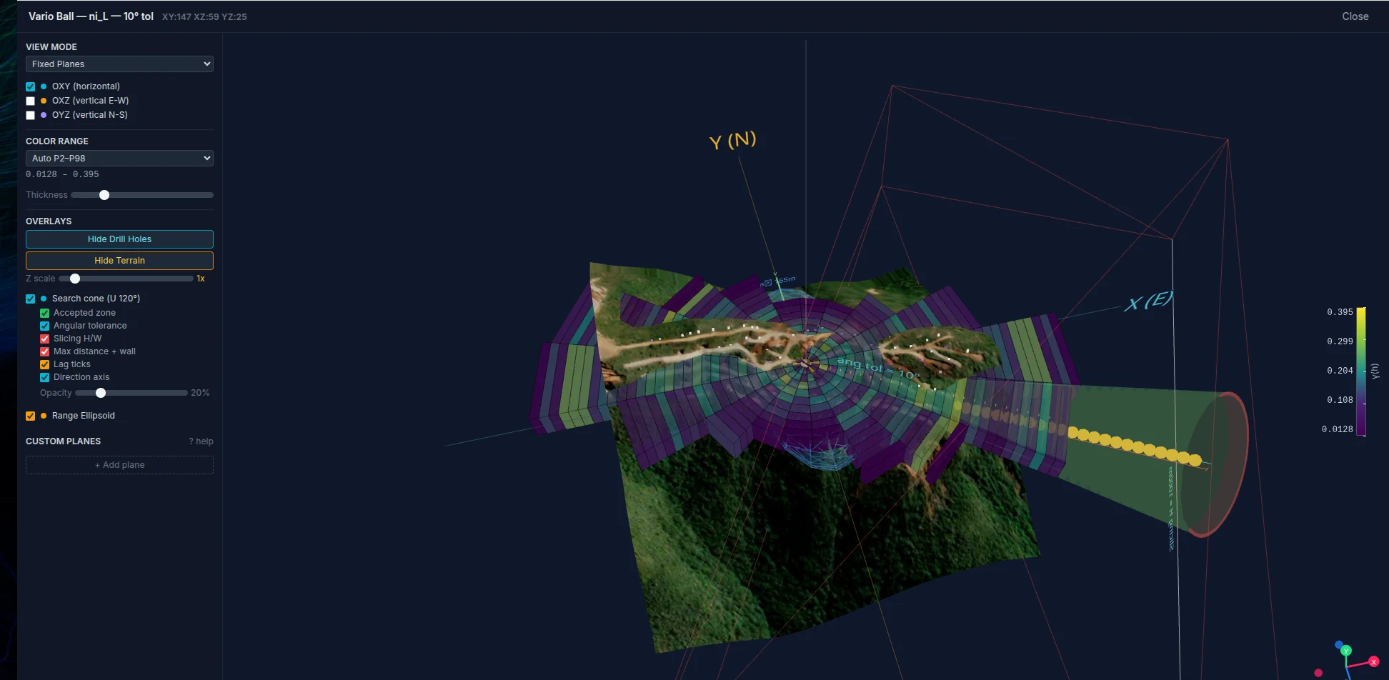
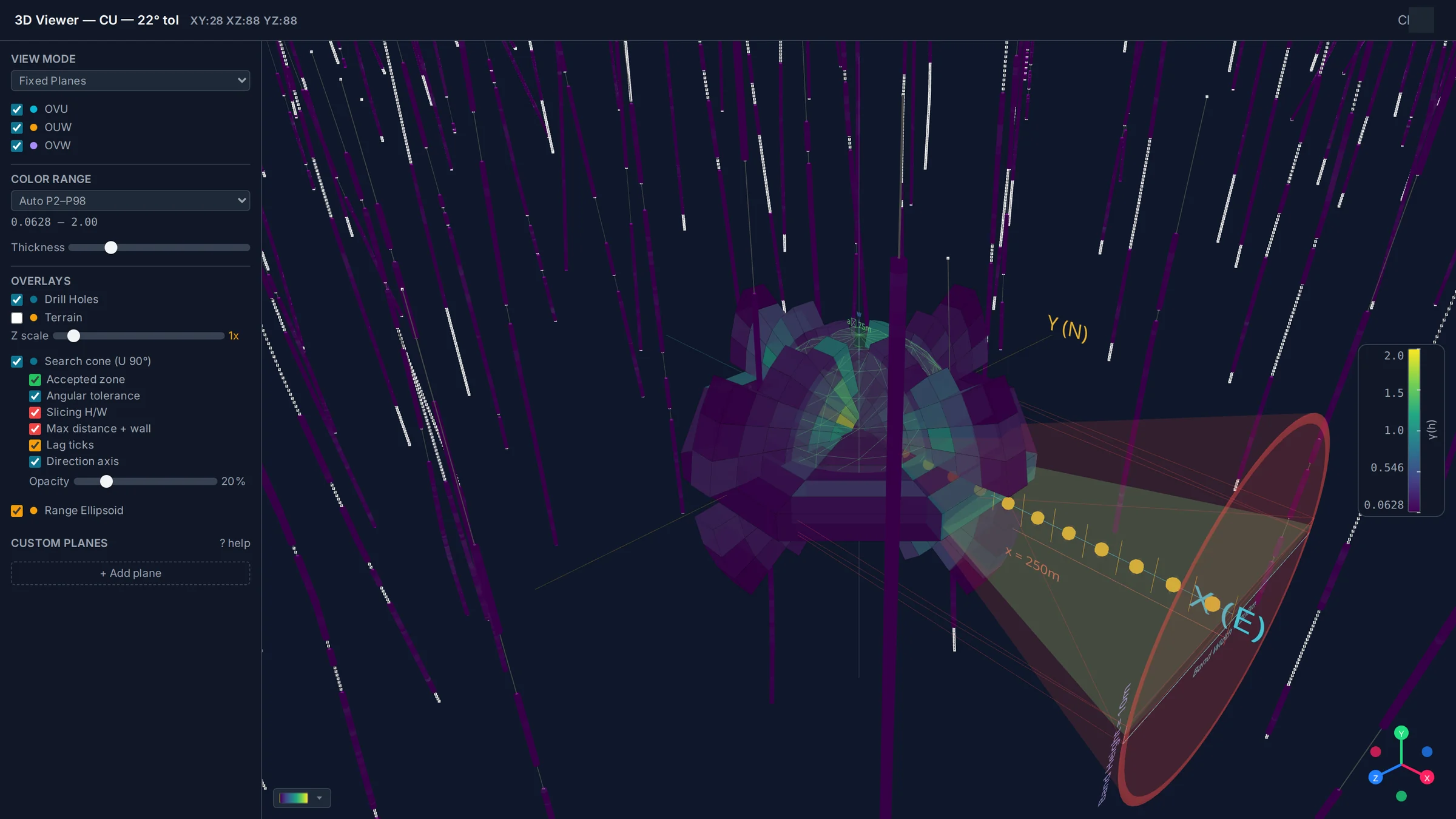
Most packages draw the result in 3D. Drawing the parameters in 3D — the cone that accepted the pairs, on the holes that produced them — is what turns a review meeting from an argument about numbers into a conversation about geology.
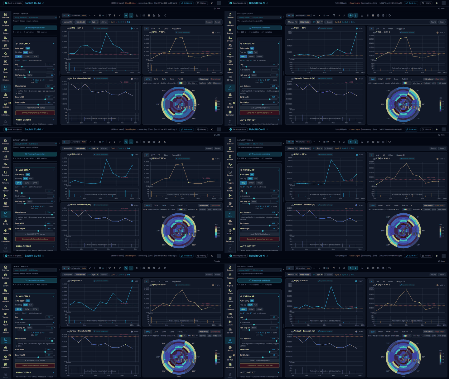
Move the azimuth, the tolerance, the bandwidth, the lag or the grade and the curve is already redrawn. When a variogram costs nothing to ask for, the question stops being "which one do we have time to fit" and becomes "which reading of this orebody survives".
What changes on Monday
No transformation programme, no eighteen-month rollout. These are the differences a team notices in the first fortnight, and they are the ones a finance director can check afterwards.
Designing a Datamine workflow — import, block model, grade interpolation, plots — took five days and now takes one, because the routine is assembled once on the canvas and driven from there instead of being re-typed step by step. The variography moves the same way: what used to be a fortnight of fitting is an afternoon, because asking for another variogram costs nothing.
Most estimation errors are not statistical. They are a wrong projection, a flipped dip convention on the survey file, a stale composite, a grade shifted by one column, a search ellipsoid typed into the second package that no longer matches the first. Nothing is re-entered here because nothing moves by hand — and where the drillholes leave a convention ambiguous, the app states the assumption it made rather than making it quietly.
Most of the people who need to see an orebody never need to model one — the mine manager, the metallurgist, the graduate, the auditor, the partner, the investor. Today each of them needs a seat of whatever the model was built in, or a screenshot. Here they open a link. The specialist licences stay where they are and keep doing the work; you just stop buying seats so that people can look.
Every step is written as it runs, with the parameters it ran with, and it exports in one action. The week normally spent reconstructing which file, which cut-off, which search and which version is a week spent recovering something that should never have been lost. It is the cheapest of the four to verify: ask to see the trail.
Straight answers
The screenshots on this page are a 399-hole, 35,616-sample drillhole study, and the variography on it is immediate. The engine is built so that the size of the campaign changes what happens underneath rather than what you experience. Bring your worst dataset to the technical review; that is the honest way to answer this one.
Good, that is the point. OreFrame does not ask you to leave them; it drives them. The routine is assembled on the canvas and comes out as macros and scripts those packages run, so the licence you already pay for keeps doing the work while the method becomes something your whole team can read.
Bring one dataset
No procurement cycle, no install, no two-day training course. Bring a collar / survey / assay trio from a deposit you know well. We load it in front of you, you take a direction off the variogram map yourself, and you see how long it takes to test the interpretation you have been putting off.
Ninety minutes. You drive.
contact@oreframe.com
 beta
beta